


WATCH: Further 'significant' snow forecast for same Highland areas battered by Storm Gerrit, warns Met Office
Register for free to read more of the latest local news. It's easy and will only take a moment.

This weekend is likely to bring further "significant snow", rain and strong winds to the same Highland areas battered by Storm Gerrit earlier this week, the Met Office has warned.
As we head into the Hogmanay weekend, a band of strong winds and rain is expected to push in from the south-west during Saturday but, as with Storm Gerrit before it, this is forecast to drive up against cold air over the Highlands, where it will turn to snow, particularly over the high ground but even potentially to lower levels.
Forecasters are predicting air temperatures as low as -7C overnight in parts of the Highlands tonight ahead of the arrival of the weather front on Saturday.
Related: 48-hour wait for all Storm Gerrit power cuts to be resolved, customers warned
Related: 'Why was Storm Gerrit emergency not declared sooner?' asks Highland MSP
In the Met Office's latest "Weekend Forecast" video, meteorologist Alex Burkill said: "We are likely to see significant snow across northern areas [on Saturday], particularly over the higher ground of Scotland.
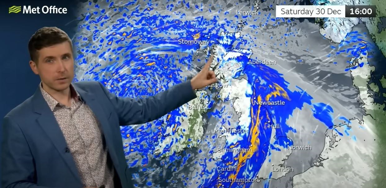
"Over the highest ground we could see 10-20cm of snow building up. And even to lower levels there is a potential for some snow accumulations – even as low as perhaps 100 metres up we could see some slushy snow. So [we're] likely to see some travel disruption because of the wind, the rain, and some snow."
Areas not cold enough for snow, meanwhile, are expected to face further rain on top of already saturated ground.
Hogmanay, meanwhile, is expected to start with the same deep area of low pressure centred over the UK, bring north-easterly winds to the Western Isles, but things may be a bit quieter overall in the north, with Mr Burkill adding that parts of the Highlands may perhaps experience "some drier, brighter weather". However, he added that "any showers here could turn wintry over higher ground, and for many it is going to be a largely cloudy day".
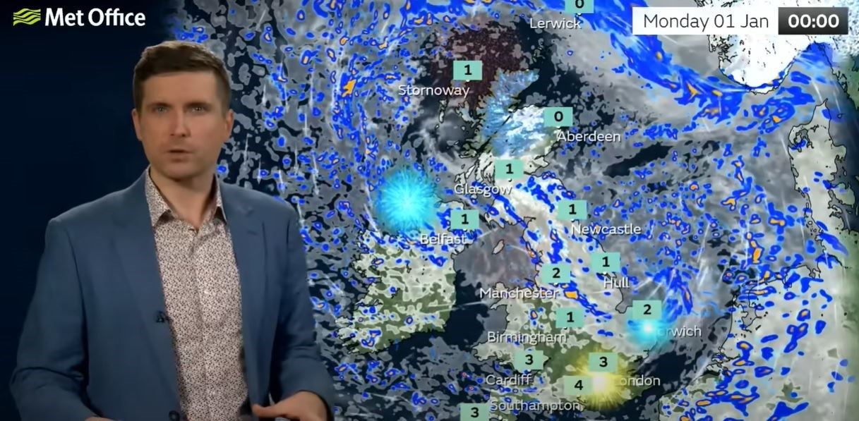
Some "decent dry weather" and sunshine is also forecast for much of the Highlands on New Year's Day, although this forecast is subject to change as we head into the weekend.