


Highland snow warning upgraded to amber as heavier snow and drifts forecast
Register for free to read more of the latest local news. It's easy and will only take a moment.

Even heavier snowfalls are being forecast for parts of the Highlands after the Met Office upgraded its weather warning for the region to amber.
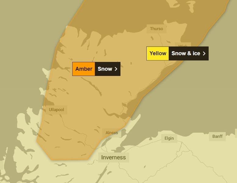
The existing yellow alert, which covers the whole of the Highlands, was joined by an amber alert on Wednesday morning – ahead of forecasts for up to 20cm of additional snowfalls in some places.
The amber alert comes into force at 3pm on Wednesday and covers all of Caithness, Sutherland, as well as large swathes of Ross-shire.
- Related: SNOW UPDATE: More than 100 schools across the Highlands to remain closed after heavy snowfall
- Related: SNOW UPDATE: Stagecoach suspends Highland bus services as heavy snowfall brings further travel disruption
- Related: 'Considerable' avalanche risk on Highland mountains, as warning level raised
Announcing the amber warning, a Met Office spokesperson said: "Further frequent, occasionally heavy, snow showers will affect the Northern Isles and northwest Scotland through Wednesday evening and Thursday with an additional 5-10 cm of snow likely, and the potential for a further 15-20 cm of snow in a few locations.
"In addition strengthening northerly then northwesterly winds will cause lying snow to drift."
The amber warning, which also extends across Orkney and Shetland, will remain in place until 6pm on Thursday.
The wider yellow warning for snow and ice that is currently in force across all of the Highlands, is expected to remain in place until the very end of Thursday.
Two further yellow warnings have also been issued for large swathes of the Highlands for Friday and Sunday.
The warning for Friday is for snow, amid predictions of five to 10cm "quite widely" but as much as 20cm in some places before gradually turning to rain at lower levels.
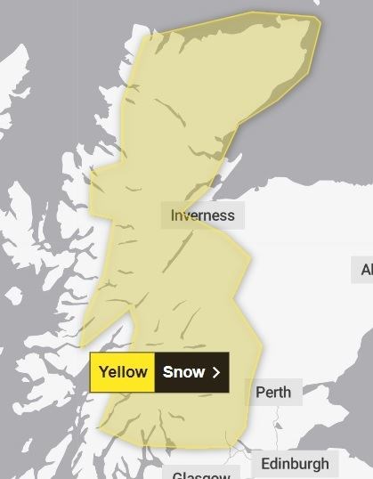
The alert will be active for the whole of Friday and extends across Caithness, parts of Sutherland, Ross-shire, the Great Glen, Badenoch and Strathspey, and south as far as Stirling, Loch Lomond and Long Long.
A Met Office spokesperson said: "Snow showers continuing through Friday with accumulations of 5-10cm quite widely, but an additional 20 cm are possible over higher ground. Drifting of fresh and existing snow cover will add to the impacts.
"Snow will fall at most levels at first, but turning to rain at low levels with snow mainly above 400m by the end of the day."
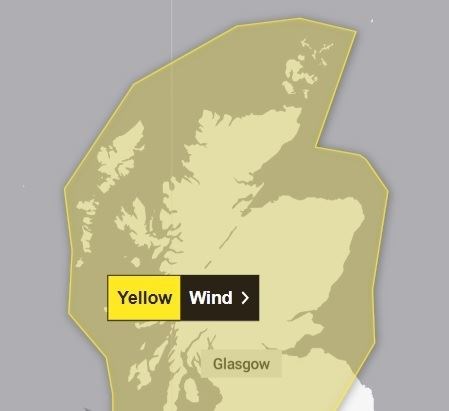
A yellow warning for wind has also been announced for Sunday, when gusts of up to 70mph "or even higher" will be possible. It will run from 6am until the end of the day and will apply to all parts of Scotland except for Shetland.
The Met Office spokesperson added: "A period of strong winds and persistent rainfall is expected across parts of the UK during Sunday. Whilst there is still some uncertainty as to the exact locations which will see the strongest winds, northern and western areas are likely to be most at risk.
"Many inland areas are expected to see gusts of 50-60 mph during this period. Coasts and exposed locations could see gusts of 60-70 mph or even higher."