


Cromarty History Society explore tale of burgh town in six historic maps
Register for free to read more of the latest local news. It's easy and will only take a moment.

FASCINATING historic maps offered an intriguing insight into Cromarty's past and that of the wider area during a special lecture recently.
Speakers Liz Broumley and Pat Haynes discussed 'The Story of Cromarty in Six Maps' at the April meeting of Cromarty History Society.
The pair, who are members of the society, carried out extensive research, finding 147 maps of relevance before carrying out an exercise of severe culling to give the talk.
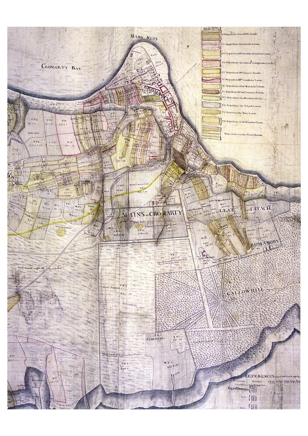
In the end they presented six groups of maps – each group representing an historical period. From each group they choose what they regarded as the “essential” map to tell the story. The range of maps and plans was diverse and eclectic, representing Cromarty both as a very specific settlement and its place in the wider world.
"Their talk made us realise that maps are not just about geography, they can also be used to show power, possession and governance," said a spokesman. "They can indicate how a place develops over time and in the way it is viewed by the rest of the world.
"So, we travelled the area with geological maps, archaeological plans, Ordinance Survey maps, maps showing trade routes, military maps, topographical maps, Admiralty maps and WWI and WWII plans showing both land and sea defences
"The features of the town were highlighted and its reputation as a safe harbour, an economic force and location of significance. It was fascinating to see an 18th century game with a map in which Cromarty was featured – showing its significance at the time. We gained knowledge of cartographers over a period of 500 years.
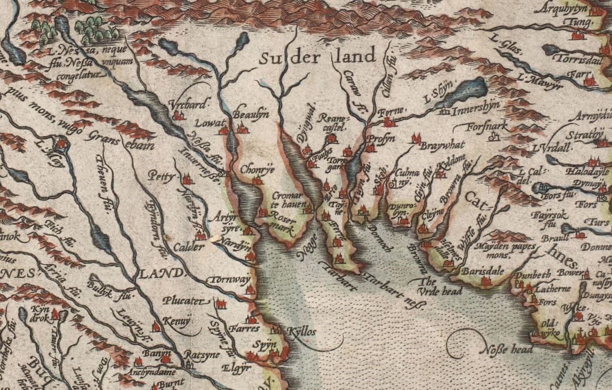
"For example, Timothy Pont, who was the first Scot to set out to survey the whole country, at the end of the 16th century. Then there was Robert Gordon, who was asked to complete Pont’s maps of Scotland for publication by Charles I.
"Joan Blaeu, from a successful Dutch map making family, produced an 11 volume atlas of the whole world. His maps added the county boundaries, giving information about the governance of a country. William Roy conducted a survey across Scotland after Culloden to produce maps for military purposes. There were many others as well.
"Alongside this journey through map-making; the development of the town was discussed with related images. The final slide was of Google Earth – we’d reached the age of satellite maps and satellite navigation. But nothing compares to a good paper map!"
This meeting was preceded by a short AGM during which the strong membership and regular visitors to all meetings were highlighted.
The programme for the next season has already been devised. Watch their website for further details at www.cromartyhistory.scot.