


200mm of rain sparks landslide warning and heightened amber Met Office alert for Highlands and Argyll
Register for free to read more of the latest local news. It's easy and will only take a moment.

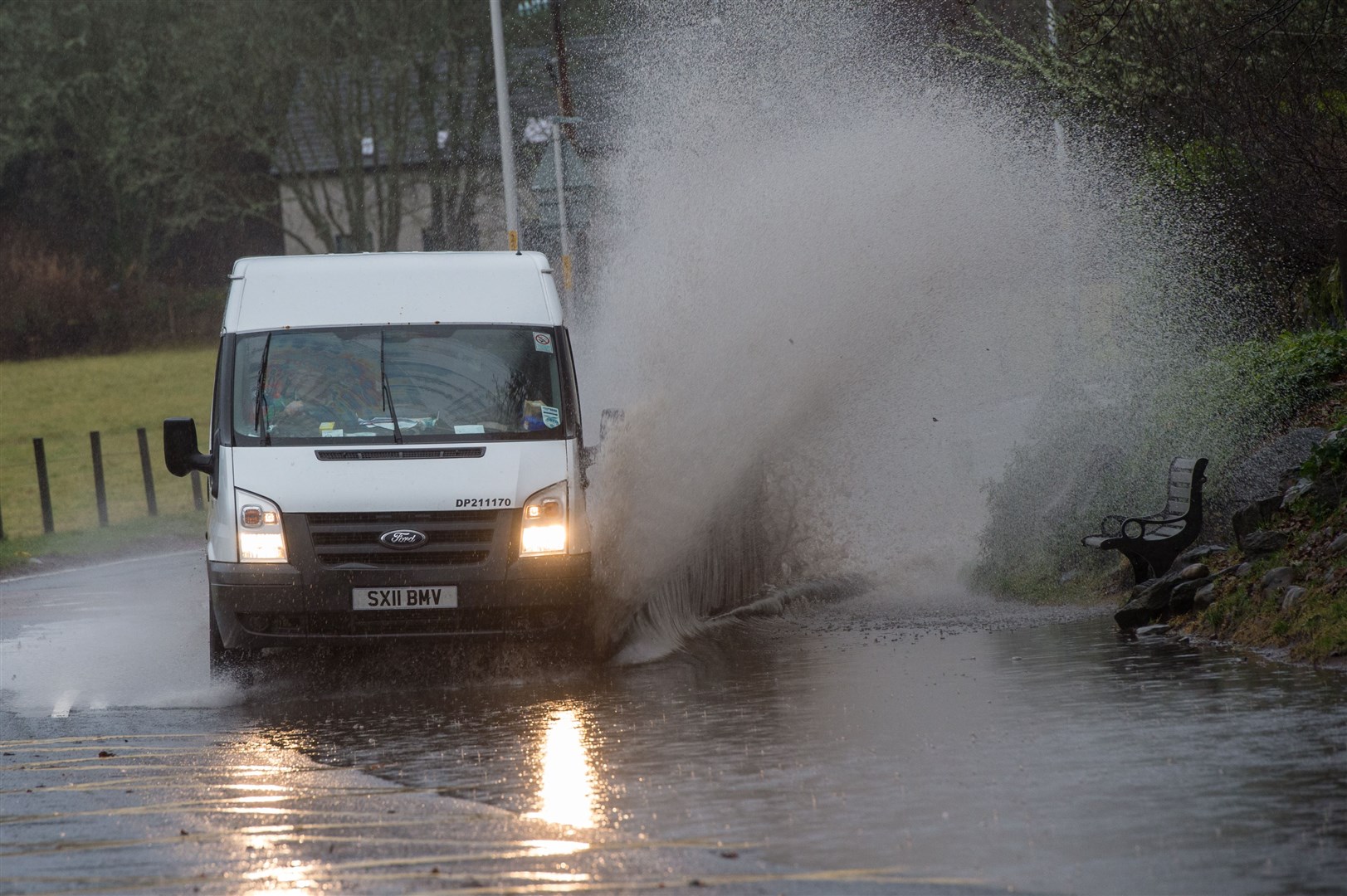
Torrential rain could bring up to 200mm of precipitation this weekend and risks triggering landslides, the Met Office has warned after upgrading its weather warning to amber.
The forecaster has raised the alert level, extended the area covered by the existing warning, and has also advised residents and motorists that the rain could fall for longer than originally predicted.
Up to 200mm of rain is possible on west-facing hills, while 100-150mm is "likely" in the wider area.
Related: 175mm of rain forecast this weekend: sparks Met Office yellow weather warning for the Highlands
The new amber warning area, which runs for the whole of Sunday, extends from Loch Eriboll in northern Sutherland and south through a large swathe of the western Highlands and into Argyll. Central and eastern Skye is also at risk.
The wider yellow warning, meanwhile covers all of western Sutherland, Wester Ross, part of the Great Glen, all of Lochaber, Mull and parts of Argyll. It extends as far south as Loch Lomond and the Cowal peninsula.
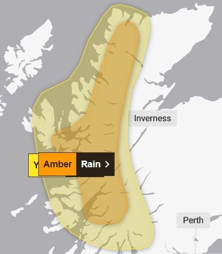
It comes into force at 6pm on Saturday and will now remain place until 6am on Monday. It had previously terminated at the end of Sunday.
Commenting on the amber alert, a Met Office spokesman said: "A prolonged spell of heavy rain is likely to affect this area accompanied by strong south-westerly winds. The heaviest rain will be focused on west-facing hills and here some places may see around 200 mm of rainfall, whilst more generally 100-150 mm of rain is likely.
"This significant rainfall also has the potential to trigger shallow landslides and debris flows, most likely across the south of the Highland region and Argyll."
That final sentence is likely to raise concerns of possible landslips around the Rest and Be Thankful in Argyll, in particular, but will also generate concerns more widely.
Turning, their attention to the yellow alert, the Met Office spokesperson added: "The warning area has been extended south and the likelihood of impacts increased. The warning has also been extended to account for residual impacts lingering into early Monday, particularly across western Highland."
They continued: "A slow-moving weather front is expected to lead to a prolonged spell of heavy rain developing this weekend. Rain is expected to begin on Saturday morning with the heaviest rainfall occurring during Saturday night and Sunday morning.
"Whilst there is some uncertainty in how long rain will persist later on Sunday, 75-125 mm is likely to fall fairly widely, with 150-175 mm possible in a few places over higher ground. Strong southwesterly winds will accompany this prolonged rainfall."