


170mm of rain forecast sparks Met Office weather warning for Highlands
Register for free to read more of the latest local news. It's easy and will only take a moment.

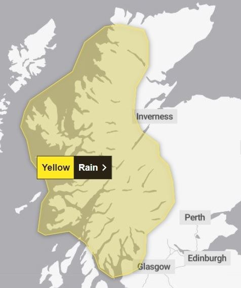
A yellow Met Office weather warning has been issued for large parts of the Highlands after forecasts suggested up to 170mm of rain could fall this weekend.
A "lengthy period" of persistent rain is expected to arrive in the Highlands on Sunday, and the Met Office has issued an alert running from 6pm on Sunday until 9pm on Monday evening.
The "persistent and at times heavy rainfall" is likely to cause disruption, "especially to travel".
Forty to 75mm of rain is expected "quite widely" but forecasters are warning of the potential for up to 170mm in the wettest spots – including Wester Ross and Lochaber.
The warning area extends from Kinlochbervie in the north to the southern tip of Bute in the south. Areas covered by the alert include western and central Sutherland, Wester and Mid Ross, Skye, Raasay, the Small Isles, Loch Ness and the Great Glen, parts of the Cairngorms, Lochaber, Mull, northern Argyll, the Cowal peninsula, Loch Lomond and the Firth of Clyde.
A Met Office spokesperson said: "A lengthy period of rain looks likely to develop across parts of western Scotland on Sunday and Monday.
"Initially, rain will slowly push north through Sunday, before pivoting and then returning south later on Monday.
"Some southern parts of the warning area may see a drier interlude for a time on Monday and there is some uncertainty as to how far north the rain gets. 40-75 mm of rain may fall quite widely in the warning area, but there is potential for 120-170 mm in the wettest areas, this perhaps most likely in parts of Argyll, Lochaber and Wester Ross."