


Met Office issues second yellow warning for gale force winds on Wester Ross coasts; alert comes amid disruption to CalMac's Ullapool-Stornoway ferry services
Register for free to read more of the latest local news. It's easy and will only take a moment.

WESTER Ross coasts will be battered by gale force winds again tomorrow, Met Office forecasters have warned after issuing a second yellow warning for the area.
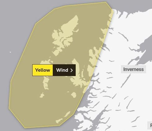
One yellow warning for strong winds is already in force for all west coast areas from Tiree in the south to Cape Wrath in the north. The alert, which is in force until 6pm on Tuesday, has already sparked two cancellations on CalMac’s Ullapool-Stornoway ferry service and a warning that the 5.30pm journey may also be disrupted – amid forecasts for gusts reaching up to 70mph in some places.
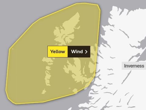
And the Met Office has now issued another wind warning for Wednesday, with wind speeds of up to 75mph being predicted. This second alert, which still encompasses Wester Ross coasts, covers a smaller geographical area than that of Tuesday’s – but includes the entire Outer Hebrides, the Small Isles, Skye and Raasay, and pushes north past Stoer Point on the mainland.
It will be in force from 10am on Wednesday until 10pm the same day.
Describing this second alert, a Met Office spokesman said: “South or southwesterly winds will strengthen again on Wednesday, with gusts reaching 60-70mph quite widely, perhaps reaching 75mph in a few locations for a time before gradually easing through the evening.”
They have warned that delays to road, air and ferry transport “are likely” and that coastal areas may experience sea spray and large waves.
CalMac has warned that Wednesday’s ferry crossings may also be “liable to disruption or cancellation at short notice” and has advised passengers to check before travelling at www.calmac.co.uk.
Related news: Traffic restrictions in place on Highland bridges