


Fresh Met Office yellow weather warnings issued for heavy rain and wind in Ross-shire and other parts of Scotland; rain warning covers area from the Applecross peninsula and northern end of Loch Ness in the north to the Solway Firth in the south; wind alert covers whole of Scotland
Register for free to read more of the latest local news. It's easy and will only take a moment.

FRESH yellow weather warnings have been issued for Ross-shire by the Met Office, as the recent stormy spell shows little signs of slowing up.
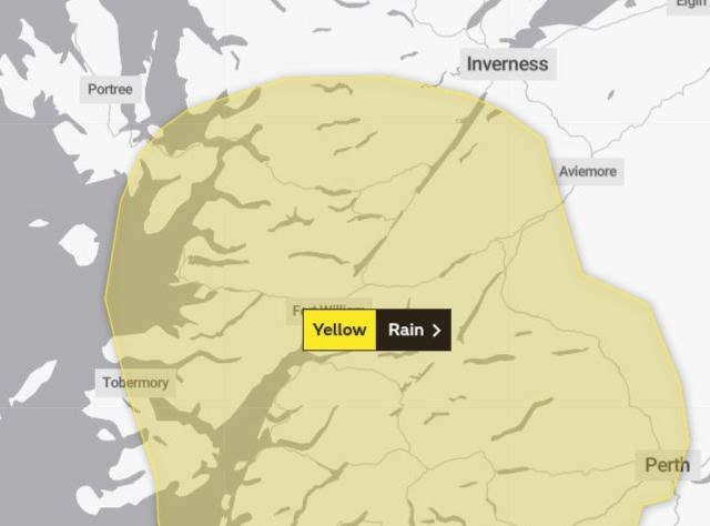
A yellow warning for heavy rain is set to come into force across southern parts of Ross-shire and Inverness-shire at 6am tomorrow.
The alert’s northern border covers an area extending from the Applecross peninsula and Lochcarron in the west, to the northern end of Loch Ness and Monadhliath Mountains in the east. It also extends all the way down the west coast from Applecross in the north to the Solway Firth in the south.
It will remain in force from 6am until 9pm.
A Met Office spokesman said that the heavy rain could lead to travel disruption and local flooding on already saturated ground.
A Traffic Scotland spokesman, urging motorists to take care, said: "Persistent and sometimes heavy rain is expected across the western and central Highlands along with southern Scotland on Friday.
"Accumulations of 30 to 40 mm are likely on high ground with peaks of 60 mm across the southern and central Highlands. Drier conditions will extend from the northwest through the evening."
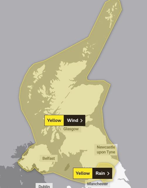
The second alert, this time for strong winds, will come into force at 6am on Saturday and run until 10pm the same day. It covers the whole of Scotland, Northern Ireland and much of northern England.
“Strong gusty winds in association with showers may bring some travel disruption,” the Met Office warned.
They added that road, rail and ferry transport might be affected, and that short term power outages are a risk.
Large waves and spray may also hit coastal communities.
Traffic Scotland added: "Strong, gusty winds are expected across Scotland, Northern Ireland and parts of northern England during Saturday.
"The strongest winds will likely occur in the vicinity of heavy, squally showers. Whilst not all areas will see the strongest winds, gusts of 55-65 mph are expected in places.
"Exposed parts of northern and western Scotland may see gusts of 65-75 mph. Showers will fall as a mixture of rain, hail and sleet with snow accumulations expected to be restricted to higher ground (above 200 to 300 m).
"Winds will gradually moderate during Saturday evening."
For the latest Met Office updates, visit its weather warnings webpage.
For the latest travel updates, visit Traffic Scotland's website.
- Click here to read the latest Ross-shire Journal news.