


Ross-shire beauty spots revealed as 4G coverage 'not-spots' in new North Coast 500 connectivity study
Register for free to read more of the latest local news. It's easy and will only take a moment.

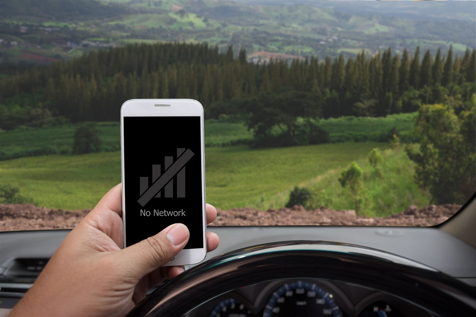
The North Coast 500 may have become one of the most internationally popular driving routes on social media, but a new survey warns there are still areas on the 516-mile route where travellers will struggle to connect with any 4G service at all.
The new mobile mapping survey from Scottish connectivity specialist FarrPoint found that more than 34 miles of the North Coast 500 is without coverage.
FarrPoint has made the interactive map freely available to tourists in a bid to raise awareness of connectivity issues and warned holiday-makers planning on tackling the route this Easter to be aware of coverage not-spots to avoid any nasty surprises.
After surveying the length of the route which circles northern Scotland with its Coverage Mapping solution, FarrPoint identified more than 34 miles of road without 4G coverage from any of the UK's 4G providers, EE, O2, Three and Vodafone.
It also found that more than a quarter of the route is only covered by either one or two of the four mobile providers.
The digital not-spots extend across some of the most popular tourist hotspots on the road trip – including Inverewe Garden and Estate, the Applecross Peninsula, Beinn Eighe National Nature Reserve and the much photographed Clachtoll Beach.
The road hugging the shoreline of Loch Eriboll – the deepest sea loch in Britain – was found to be the worst area for mobile coverage along the route, with more than 18 miles of continuous road without any 4G coverage. This will leave travellers with real connectivity issues when trying to access mobile data and making calls and texts.
FarrPoint is encouraging drivers to consider downloading digital maps before setting off on the epic road trip so they can be accessed in not-spot areas, as well as checking the level of coverage that specific mobile operators offer.
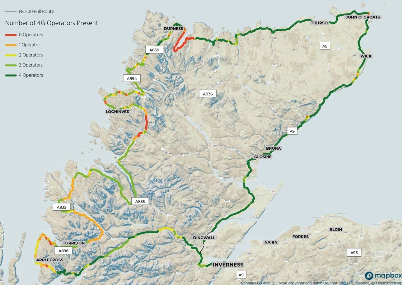
According to FarrPoint’s analysis, EE offers the best coverage with the network accessible on 89 per cent of the route, closely followed by O2 with 77 per cent and Vodafone with 76 per.
Three came last, only providing coverage for 51 per cent of the route – leaving more than 252 miles without 4G coverage.
FarrPoint chief executive Andrew Muir said: “With stunning scenery and views, the North Coast 500 provides the setting for one of the world’s best road journeys right here in Scotland. But without adequate preparation, the trip could turn into difficulty in parts given the remote nature of the surrounding area and the limited connectivity across the route.
“With more than 34 miles of the route having no 4G coverage from any operator, and hundreds of miles of road only being covered by certain operators, undoubtedly people will experience connectivity issues during their journey. This may appeal to some travellers who are looking to have a break from their digital devices, but it could equally cause issues if drivers get lost or run into trouble.
"To help provide better peace of mind, we recommend that drivers check their mobile connectivity and download any maps of areas before they set off to ensure they don’t get lost in this remote, albeit undeniably beautiful part of northern Scotland.”
FarrPoint has made the interactive version of the map available for use on its website at www.farrpoint.com/nc500-mobile-coverage-map, and visitors are encouraged to look at what their operator’s coverage levels are in advance so they can make informed decisions before they travel.
FarrPoint has also mapped 4G coverage in other locations across Scotland, the UK and Canada, working with local authorities and governments to assist them in building an accurate picture of connectivity so that infrastructure investment decisions can be made more effectively.